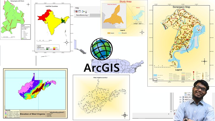
ArcGIS Pro[2026]: Mapping, Spatial Analysis, 3D & Automation
ArcGIS Pro[2026]: Lập bản đồ, Phân tích không gian, 3D & Tự động hóa
![ArcGIS Pro[2026]: Lập bản đồ, Phân tích không gian, 3D & Tự động hóa](https://studyvn.academy/assets/uploads/course_6a179f1f24933.jpg)
4.6
(130 đánh giá)
624 học viên

Giảng viên
Dr. Abhijit Patil
Phụ đề tiếng Anh
Bán chạy
Đánh giá cao
50.000đ
399.000đ
-87%
Bao gồm phụ đề tiếng Việt, tiếng Anh
6.0 giờ video
45 bài giảng
6 bài quiz
Truy cập vĩnh viễn
Học trên mọi thiết bị
Cập nhật: 31/05/2026
Bạn sẽ học được gì
Yêu cầu
Hiểu biết cơ bản về GIS (như layer, shapefile và dữ liệu không gian) là hữu ích nhưng không bắt buộc.
Kinh nghiệm Python trước đây là lợi thế nhưng không bắt buộc.
Hệ điều hành Microsoft Windows 64-bit
Đối tượng phù hợp
Nội dung khóa học
9 phần • 45 bài giảng
1
GIS là gì? Tại sao ArcGIS Pro + ArcPy là bước đột phá (Khái niệm)
2
Thiết lập ArcGIS Pro: Dùng thử, tải xuống và cài đặt
3
Làm quen với ArcGIS Pro: Điều hướng giao diện
4
Bắt đầu với ArcPy: Cài đặt và chạy script đầu tiên (với ArcPy)
1
Hiểu về dữ liệu không gian và phi không gian (Khái niệm)
2
Nhập, xuất và sắp xếp layer
3
Tự động hóa nhập 50 shapefile tiểu bang Hoa Kỳ (với ArcPy)
4
Làm việc với geodatabase và nhập feature class
5
Tạo và quản lý geodatabase (với ArcPy)
6
Tính toán trường và chỉnh sửa bảng thuộc tính (GUI + ArcPy)
1
Hiểu về định vị và hệ tọa độ (Khái niệm)
2
Định vị bản đồ địa hình lịch sử USGS: Staten Island, New York (1896)
3
Số hóa thực hành: Điểm, đường và vùng
4
Tạo feature class và thêm feature (với ArcPy)
5
Duy trì độ chính xác: Quy tắc topology và công cụ chỉnh sửa
1
Nghệ thuật bản đồ: Nguyên tắc ký hiệu (Khái niệm)
2
Tùy chỉnh ký hiệu layer trong ArcGIS Pro
3
Áp dụng ký hiệu (với ArcPy)
4
Nâng cao bản đồ với Living Atlas Layers
5
Gắn nhãn feature và biểu thức
6
Gắn nhãn động và biểu thức (qua ArcPy)
7
Thiết kế layout bản đồ chuyên nghiệp với dữ liệu Brazil
8
Tự động hóa xuất layout bản đồ (với ArcPy)
1
Phân tích không gian: Cái gì, tại sao và ở đâu (Khái niệm)
2
Buffer, Clip và Intersect: Công cụ không gian cốt lõi
3
Tự động hóa công cụ geoprocessing (với ArcPy)
4
Phân tích raster: Slope, Aspect và Hillshade
5
Tự động hóa xử lý raster hàng loạt (với ArcPy)
1
Hiểu về truy vấn thuộc tính và không gian (Khái niệm)
2
Chọn feature theo thuộc tính
3
Chọn feature theo thuộc tính (với ArcPy)
4
Chọn feature theo vị trí
5
Chọn feature theo vị trí (với ArcPy)
1
Hiểu về GIS 3D và LiDAR (Khái niệm)
2
Trực quan hóa đám mây điểm LiDAR trong 3D
3
Tạo DSM, DTM và nDEM từ LiDAR
4
Phân tích 3D Phần 1: Hồ sơ độ cao, đường dốc nhất, tầm nhìn
5
Phân tích 3D Phần 2: Phân tích tầm nhìn và thể tích
6
Tạo tòa nhà 3D từ thuộc tính chiều cao của shapefile
7
Phân tích 3D trong ArcGIS Pro: Khái niệm và ứng dụng
1
Giới thiệu về ModelBuilder: Logic không cần code (Khái niệm)
2
Tạo và tự động hóa mô hình thủy văn với ModelBuilder
3
Tự động hóa luồng công việc thủy văn (với ArcPy)
4
ModelBuilder cho tự động hóa GIS thông minh
1
Tổng kết khóa học và hướng đi tiếp theo
Giới thiệu khóa học
Unlock the full power of ArcGIS Pro 2026 with this hands-on, practical course! Learn to create stunning maps, perform advanced spatial analysis, work in 3D, and streamline your workflows. This course is designed for GIS users who know the basics and want to become true ArcGIS Pro experts—boosting efficiency, accuracy, and impact in every project.
We focus on learning by doing. Through real-world projects, you’ll master essential ArcGIS Pro skills—from georeferencing historical maps and managing spatial data to creating publication-quality layouts and visualizations. Along the way, you’ll get introduced to Python automation (ArcPy) for key tasks, giving you a taste of scripting without overwhelming your learning path.
In this course, you will:
Build an expert foundation in ArcGIS Pro: digitization, georeferencing, map design, and data management.
Master spatial analysis: raster processing, queries, 3D visualization, and LiDAR data handling.
Automate smartly: learn basic ArcPy techniques to reduce repetitive tasks and save time.
Handle large datasets efficiently: process, manage, and analyze data like a professional.
Apply best practices: professional GIS workflows and standards for real-world projects.
Who this course is for:
GIS users ready to move beyond basics and master ArcGIS Pro
Students and researchers in geography, urban planning, and environmental studies
Professionals transitioning from ArcMap or other GIS platforms
Anyone seeking faster, smarter ways to manage and analyze spatial data
No prior Python experience is required. By the end, you’ll confidently handle ArcGIS Pro projects from start to finish and automate repetitive tasks when needed.
50.000đ
399.000đ
-87%
Bao gồm phụ đề tiếng Việt, tiếng Anh
6.0 giờ video
45 bài giảng
6 bài quiz
Truy cập vĩnh viễn
Học trên mọi thiết bị
Cập nhật mới nhất: 31/05/2026
Khóa học liên quan
Khám phá thêm các khoá học cùng chủ đề

Python cho Tự động hóa GIS và Ứng dụng Không gian Địa lý
Senior Assist Prof Azad Rasul
4.3
(45)
7,634
50.000đ
399.000đ
-87%

Phân loại sử dụng đất và lớp phủ mặt đất với GIS, ERDAS, ArcGIS và Máy học (ML)
Lakhwinder Singh
4.4
(612)
3,508
50.000đ
349.000đ
-86%



Machine Learning trong GIS và Viễn thám: 5 khóa học trong 1
Katie Alison
4.2
(529)
2,533
50.000đ
399.000đ
-87%

Dự án GIS Hoàn chỉnh: Xác định Vùng Tiềm năng Nước ngầm bằng ArcGIS
Lakhwinder Singh
4.6
(376)
1,766
50.000đ
349.000đ
-86%

Khóa học toàn diện về GIS (Phần 1 - Công cụ GIS)
Shoaib Shahzad Obaidi
4.7
(122)
752
50.000đ
1.409.000đ
-96%

Phân Tích Dữ Liệu Không Gian Cốt Lõi: GIS Nhập Môn với R và QGIS
Minerva Singh
4.4
(2341)
16,924
50.000đ
399.000đ
-87%

Khóa học chuyên sâu về Đô thị thông minh, Quy hoạch và Phát triển đô thị
Dr. José Prabhu J
4.3
(351)
13,395
50.000đ
649.000đ
-92%


Kiến thức Cơ bản về Viễn thám và Phân tích Không gian Địa lý
Matt .
4.6
(1365)
6,141
50.000đ
469.000đ
-89%


Khóa Học Cấp Tốc Về Dữ Liệu Viễn Thám Vệ Tinh Với Các Công Cụ Mã Nguồn Mở
Minerva Singh
4.4
(422)
3,110
50.000đ
399.000đ
-87%

